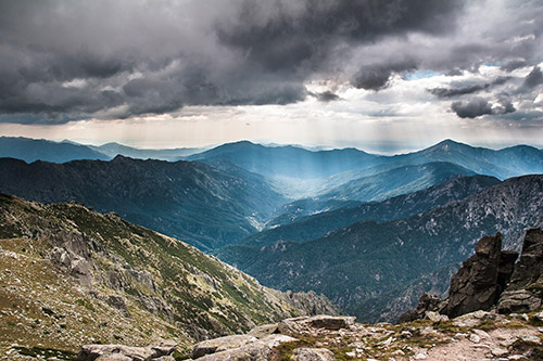
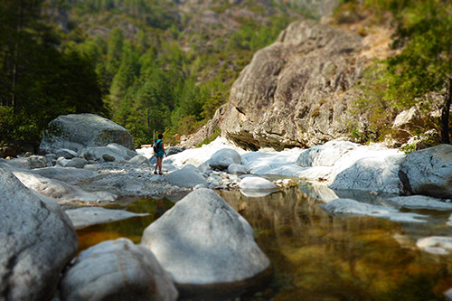
Continuing the road south of Corte, we cross the village of Riventosa, known for its Cheese Festival in May. Many swimming spots in the Vecchio river are accessible. For the more sporty, canyoning is also practiced in the region. Along the road towards Vivario you will find Gustave Eiffel’s viaduct, dating from 1892. Just above a new bridge was built for the passage of the Bastia / Ajaccio line train. The road takes us to Vivario, where we can find some shops and accommodation. The village is crossed by the Mare a Mare Nord hiking trail. 5 kilometers further, we reach the village of Canaglia, starting point for a hike to the Meli waterfall then to the Tola bridge, with swimming areas in the river. We then arrive at the village of Tattone, then Vizzavona. Highly appreciated for its large forests and its freshness, the village attracts tourists to hike the Cascade des Anglais. After an hour of walking in the forest and along the river, you will arrive at the waterfalls from below. We then leave again on the N193, which takes us very easily to the Col de Vizzavona, we arrive at the Gravone Valley. The road continues towards Ajaccio.
From the village of Ponte Leccia, you have to take the direction of Calvi/Ile Rousse to get to the Asco valley. 2km further, we turn left (D47), towards the village of Asco and its valley. The road in the heart of the Asco valley will take you through a narrow gorge and climbs continuously before ending in a deep narrow mountain valley, bordered by a mountain over 2000 meters above sea level.
Before arriving in the heart of the Asco valley, take the road towards the villages of Moltifao and Castifao. Once you have crossed the first village, you arrive at a high hill, where you can see the ruins of an ancient monastery of St. Francis di Caccia. Destroyed by the Genoese, the old wooden building was rebuilt in 1569, and expanded over the years. During the 18th century, the place was looted and part of the roof collapsed. There are now graves around the building despite the threat of collapse. When we continue the road towards the pass, we arrive at the village of Castifao and its Paganosa defense tower.
Leaving the junction towards Moltifao, the road follows the Asco river. 600 meters further is the turtle village. Inside the site, visitors can admire the different breeds of turtles found on the island, including the free-living Greek tortoise. The place is open from June to September. Following the turtle park, numerous swimming areas are accessible from the road. Just before arriving in the Asco gorge, we arrive at the adventure park and its Via Ferrata. From this site, the valley is not recommended for campervans and towing drivers. The winding road continues and leads to Asco, a mountain village of 600 inhabitants, living mainly from tourism. Below Asco, there is a Genoese bridge, one of the best known in Corsica. The clear pool is located below the bridge, where jumps of 3-4 meters are possible. Behind the village, the road leads towards Haut-Asco, and ends at the ski resort, at an altitude of 1,450m, which hosts an ESI (International Ski School). The site is a stopping place on the famous GR20 trail, but also the starting point for the Muvrella or Punta Culaghja hikes.
The Niolo valley is reached from three sides, from the Gulf of Porto, from the Verghio Pass or from the Scala di Santa Regina. In Francardo, on the road between Corte and Ponte Leccia, you have to turn onto the D84 towards Calacuccia/Gulf of Porto to arrive in the valley. There is also the possibility of taking the D13 after Castirla. Once you have passed the Golo bridge, and 5km further, you reach the Scla di Santa Regina on a winding road. Before arriving at the village of Calacuccia, we cross the dike of Lake Calacuccia, built in the 1960s. It is the main village in the Niolo valley. There are lodges, restaurants, and the Mare a Mare Nord hiking trail passes through the village. A tourist information office is also open to welcome tourists. Continuing on the D84, you arrive at the junction towards Lozzi. There are two campsites, which are the starting points for the climb to the renowned Monte Cinto, but also for other hikes. The road continues towards Albertacce, a place popular with paragliding enthusiasts. Once through the village, there are swimming places in the Golo, particularly near the Genoese bridge Ponte Altu. The D84 leads to the Poppaghja forest house, the starting point for the hike to Lake Nino. On a marked and well-signposted path, the walk takes around 5 hours round trip. The lake is located in the middle of the pozzi, small rivulets crossed by meadows. The lake serves as a source for the Tavignano, the second largest river on the island. 4km before arriving at the pass, many cars park around the hairpin bend: this is the starting point for the hike to the Radule waterfall (as well as the sheepfold of the same name). The trail covers part of the GR20. Arriving at the pass, you can see the facilities used during the winter period for the Castello di Verghio ski resort. Behind the pass, the road continues towards Evisa, then Porto.


